|
 Friday Friday
A ridge of high pressure brings a brighter day to many areas. A few showers possible, mainly coastal areas in the morning. Sunny spells, but cloud thickens from the west as fronts return from the Atlantic. Rain sets in across Northern Ireland by afternoon, later spreading to western Scotland. The breeze eases for a time, but south-westerlies freshen later in the west. A cool start, daytime highs 6 to 8C north, 9 or 10C.
 Friday night Friday night
Rain will become persistent across Scotland and northern England, heaviest over western hills, preceded by snow in the Scottish Highlands. Patchy rain also extends to central England & Wales, whilst the south of England should stay largely dry. Rain fades for a time across Ireland, but will return from the west before dawn. Blustery south-westerly winds, locally up to gale force in the west. Temperatures 3 to 8C.
 Saturday Saturday
A brisk south-westerly wind, locally gale force in the west & north. Rain will persist most of the day for north-western Britain, heaviest over western hills. Rain turns heavier later for Wales & the south-west. Ireland will improve from the west. Occasional rain spreads eastwards across central England, but the south & east should stay mainly dry. Cloudy skies for most, some brightness in the east. Mild overall, 9 to 12C.
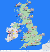 Sunday Sunday
A mild south-westerly flow affects the British Isles. A dry and bright day for central & south-eastern regions after overnight rain has cleared, although cloud will thicken from the west as fronts move back in from the Atlantic. Rain turns heavy and persistent for western Britain & Ireland. Winds freshening through the day, strongest in the west & north. Temperatures 9 to 12C, mildest in east.
|
