|
 Friday Friday
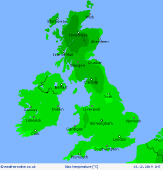
Low pressure off northeast Scotland brings rain into northern and eastern Scotland on Friday, snow on the hills. Further showers affecting western parts of Wales and western England, these tending to fade. An area of morning rain and showers could affect East Anglia and southeast England too at first, but this fading. Showers in western Ireland, drier in the east at first although some rain arriving here later. Highs at 4 to 9C.
 Friday Night Friday Night
Outbreaks of rain arrive from the southwest overnight affecting much of England, Wales, Northern Ireland and western Scotland. This turns to snow over higher ground. Showers follow to the west for western parts of Ireland and Northern Ireland. Clearer skies develop later for eastern parts of Ireland. Overnight lows widely falling to 1 to 5C, mildest to the southeast.
 Saturday Saturday
A very messy situation on Saturday as low pressure remains dominant over the UK and Ireland. There will be spells of rain, sleet and snow over northern England, Wales and much of western and southern Scotland. Some of the snow could fall at low levels although accumulations at low levels are unlikely. Drier in some central and eastern areas. Cold for all with highs at 2 to 6C.
 Sunday Sunday
A southwest flow across the UK and Ireland on Sunday. There will be further showers to the west and south. The showers will be wintry over western hills and coasts, a risk of blizzard conditions on hills in heavier showers. Eastern areas will be bright and mostly dry after overnight heavy showers have cleared. Highs at 2 to 7C.
|


