|
 Wednesday Wednesday
A weak warm front drifts across Britain. Cloudy and dull in many western areas, with drizzly rain on and off, fairly persistent over western hills with extensive very low cloud. Patchy drizzle extending eastwards at times across Britain, but amounting to very little in the south. Limited sunshine breaking through occasionally. Light to moderate westerly winds. Highs 16 to 20C, warmest in east & southern England.
 Wednesday night Wednesday night
Mostly cloudy skies, with further drizzly rain affecting hills in the north and west of Britain, also across Northern Ireland, although total rainfall small. Generally dry for central, south and eastern Britain. Murky around coasts in the west. Light to moderate westerly winds prevail, strongest around western coasts. Staying mild, lowest temperatures 11 to 15C.
 Thursday Thursday
Variable cloud and occasional sunshine for England, Wales and eastern Scotland. A little patchy drizzly rain possible in central England for a time in the morning, but largely fading out. Light winds in the south, where it will feel quite humid, whilst a stronger southwesterly affects Scotland and Northern Ireland, bringing rain or drizzle to western areas. Highs 20 to 23C south and east, 15 to 17C northwest.
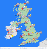
 Friday Friday
Weak fronts trailing across northern Britain and Ireland bring cloudy skies, drizzle and some persistent rain, mainly to western hills in Scotland. A little drizzle coming into the Lakes and north Wales too with a lot of low cloud. Dry with some sun for central, southern and eastern England and Wales, and feeling humid. Light to moderate southwesterly winds. Highs 18 to 23C, but up to 26C in southeast.
|
