|
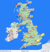
 Monday Monday
A rather misty, murky day across southern parts of England and Wales with any patchy bits of drizzly rain fading away. It may brighten up in places during the afternoon as it turns dry, warmer and humid. A belt of heavy rain moves across Northern Ireland, northern Wales in the morning then into western and southern parts of Scotland, northern England into Lincolnshire. Expect maximum temperatures of 17 to 24 Celsius.
 Monday Night Monday Night
In the evening that area of heavy rain clears northern England in the evening and most of Northern Ireland and affects the central belt of Scotland. A dry evening across the rest of England and Wales with low cloud and mist developing during the night. Overnight rain lingers through central parts of Scotland. Mist, low cloud and patchy drizzle may affect western coasts of Britain. A warm, humid night with minimum temperatures of 13 to 17 Celsius.
 Tuesday Tuesday
Warmer across England and Wales today. An area of persistent and heavy rain across northern Scotland tends to clear away this morning. Apart from a few scattered showers across Northern Ireland and Scotland, it should be fine and dry with low cloud breaking to sunny spells. A number of showers affect northern parts of England, Northern Ireland and Scotland into the evening. Overnight showers to affect Scotland with the rest of Britain dry with mist patches by morning. Expect highs of 20 to 25 Celsius.
 Wednesday Wednesday
It continues warm in the south. Expect a good deal of dry weather today with good spells of sunshine. There is a risk of a few scattered showers across Scotland, Northern Ireland and western parts of Wales. Cloud thickens across Northern Ireland in the evening bringing in rain to Northern Ireland overnight. A few showers persist across western parts of Britain with most areas dry with clear spells. Expect highs of 18 to 24 Celsius.
|
