|
 Tuesday Tuesday
An unsettled day as low pressure spirals across Britain. Areas of heavy showers as well as longer spells of rain across the country. The most prolonged heavy rain across central, east and northern England. Early heavy rain across Wales and the Southwest will soon break up into showers. Some heavy and possibly thundery showers for Scotland and Northern Ireland. Windy across southern Britain, gales for a time around exposed coasts, gusts locally over 50mph. Light winds in the north. Highs 14 to 20C.
 Tuesday night Tuesday night
Clusters of showers will continue to affect some areas, mainly in the north and west. A risk of some more persistent rain in north-eastern Scotland. A few showers will pass eastwards but eastern regions will be drier. Staying windy in the south but not as strong as Tuesday daytime. Lighter winds in the north but some north-eastern coasts will be blustery. Low temperatures of 8 to 13C.
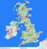 Wednesday Wednesday
A trough of low pressure still influences Britain. Sunny spells and some locally heavy bursts of rain are expected, these locally frequent over a few hours, passing from west to east. The far south and southeast may avoid the worst of the showers and enjoy the best of any brightness. Western coastal regions will tend to become drier and sunnier during the afternoon. A fresh south-westerly breeze across Britain, highs from 15 to 21C.
 Thursday Thursday
A ridge of high pressure is building in from the west, bringing dry conditions for many areas, although there will be some developing showers, these mainly towards southern and eastern areas, locally heavy in the afternoon, but quite hit and miss, with plenty of dry conditions and sunny spells about for other regions. Mostly light winds. A warm day, especially in the south and east. Highs at 17 to 24C.
|
