|
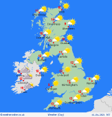
 Wednesday Wednesday
High pressure resides across Britain. Most places staying dry with sunshine and broken cloud. Locally cloud will build to allow a few scattered hail showers to form, mainly in the afternoon across western England and Wales. Winds mostly light, but a chilly northeasterly breeze will affect eastern England. A chilly start with a touch of frost for many. Reaching 10 to 12C by afternoon, locally a little warmer in the west, but staying below 8C on the east coast.
 Wednesday night Wednesday night
Skies will stay clear for many places overnight. Staying dry overall with light winds. Some local mist patches forming in low-lying areas. Cold again, with a widespread frost rurally, and close to freezing in many towns too. Lowest values -2 to -4C in prone countryside locations. Coastal fringes generally staying a few degrees above freezing. An onshore breeze for East Anglia.
 Thursday Thursday
A dry day for most places. Sunny skies in the west and north. Cloud is likely to drift in from the east across England, with a risk of a few showers developing, moving slowly westwards into the Midlands by afternoon. A cool easterly breeze for the south and east, lighter winds in the north and west. Temperatures up to 10 to 12C after a cold start. Locally 14C in northern Scotland to the lee of the Highlands.
 Friday Friday
High pressure centred over Scandinavia promotes an easterly breeze for southern England. Generally dry with plenty of sunshine. Some early mist patches. A little fair weather cloud building through the day. High cloud tending to thicken across the north and west, with strengthening southerly winds for western Scotland and Ireland. Highs 11 to 14C, but cooler around North Sea coasts.
|
