|
 Sunday Sunday
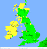
A mostly cloudy day across the UK and Ireland on Sunday with a brisk southwesterly wind for most areas. Outbreaks of rain, some heavy, for northwestern parts of Scotland with gales here while western parts of England, Ireland and Wales may see light spells of drizzly rain at times. Some brighter spells for eastern parts of England through the morning then for central and southern parts of the country through the afternoon. Highs at 7 to 11C, mildest to the north and west.
 Sunday Night Sunday Night
Rain arrives to the west overnight affecting western parts of Ireland, Scotland and Northern Ireland. Winds pick up here too reaching gale force or stronger by Monday morning. A drier night for eastern areas and for much of England and Wales though winds will pick up here too. The best of any clear skies for eastern England and southeast Scotland. Overnight lows at 4C in the southeast, 9C to the north and west.
 Monday Monday
A ridge of high pressure across eastern England at first on Monday brings a fair start to the day. Fronts will be crossing Ireland and into Scotland as well as the west of England and Wales through the morning bringing periods of rain. This rain then spreads eastwards through the rest of England and Wales during the afternoon. Brighter conditions but with heavy showers follows into Ireland. Windy for all. Highs at 8 to 12C.
 Tuesday Tuesday
A mild day with strong south-westerly winds affecting all areas. There will be some drizzle over western coasts of Wales and southwest England. Dry in central and eastern areas. Heavy rain in central and western Scotland, this rain affecting Northern Ireland and northwest Ireland too. Gales in northern and western Scotland. Highs at 11 to 14C.
|
